Support Us Button Widget

Kansas City’s regional trails and bikeways map

Plus, here’s how you can make it better.

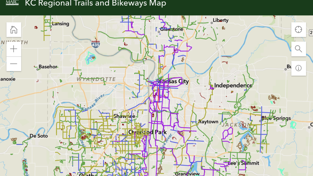
Screenshot of interactive trails map

Make 2023 your outdoorsy year.

Map via MARC

The Mid-America Regional Council is asking for public feedback to improve its regional trails and bikeways map. But did you even know this exists?

Answered: “Where can I find a comprehensive map of area bike trails?” — Reader Karen A.

This map provides a comprehensive, color-coded look at all of the types of paths across the metro. Here are a couple tips for using it:

  • You can access the key in the bottom left button, which explains the colors (from pedestrian paths to mountain bike and equestrian trails).
  • You can toggle layers in the bottom right button, even layering in trail head parking and local libraries.

Once you start using this tool (we recommend the ol’ bookmark trick), MARC wants your input on ways to make it better. Take this survey, and help improve this public tool for everyone.

More from KCtoday
Need some new places to pop the bubbly? Don’t worry, KCtoday has the scoop on the 10 best spots to watch the ball drop on Tuesday, Dec. 31.
Well, maybe not us directly — but KC really is the gift that keeps on giving.
For the new year, we’re asking readers to submit their top questions about Kansas City for us to answer.
Let’s take a look at some snowy stats.
2024’s Google Year in Search is out — check out what Kansas Citians were searching most this year (it might surprise you).
Kansas City is working towards a greener downtown with the South Loop Project. Check out renderings of the project + its 2026 completion goal.
We have 10 of the most recognizable Kansas City landmarks — from bright signs in the night sky to beacons of stone and metal.
A fresh new look is coming for the city’s award-winning farmers market.
Get into the holiday spirits. 🍸
Prepare for winter weather in KC with these seasonal temperature and precipitation outlooks.